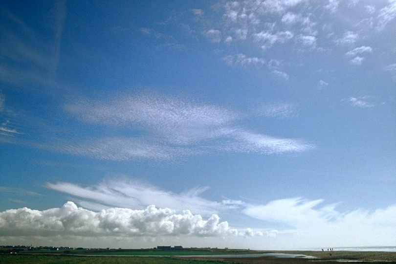
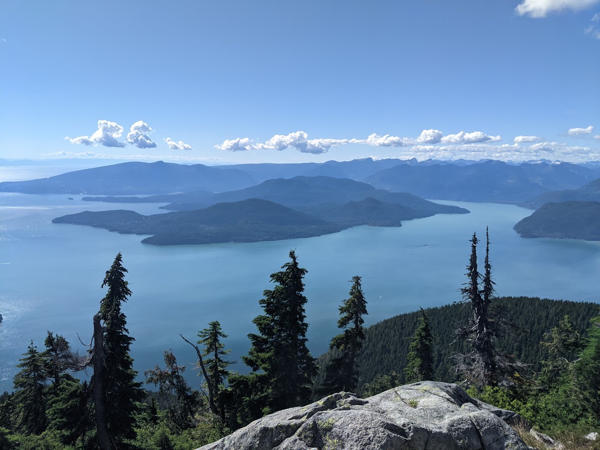
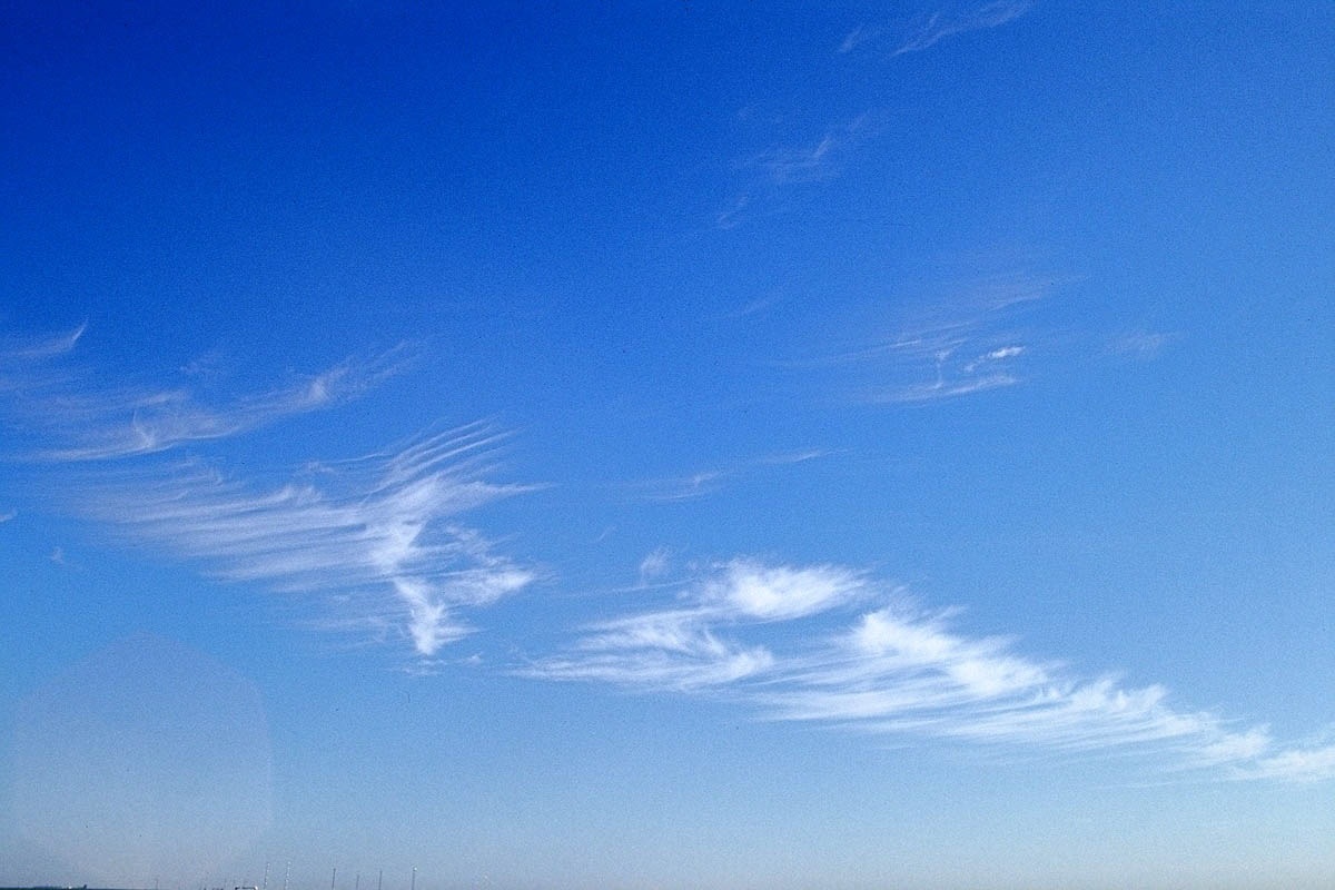
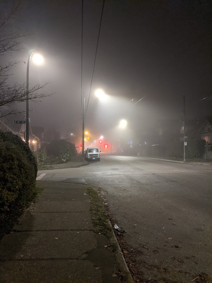
Clouds and Precipitation
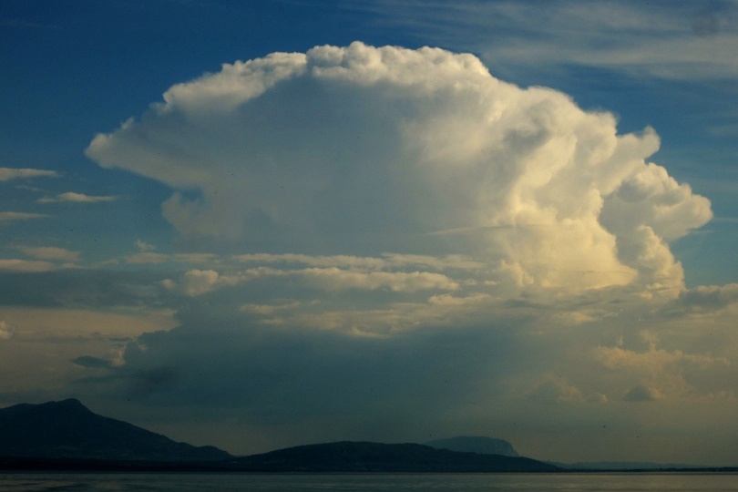
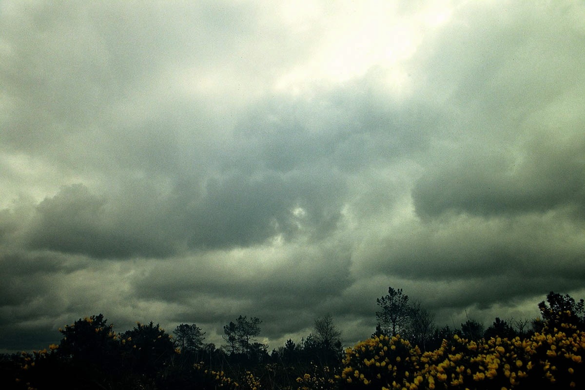
A range of different clouds is represented on this picture - ice clouds (cirrus) and liquid water colds (cumulus) Photo: A. Christen
Learning Objectives
- Describe cloud formation in the atmosphere
- Why:?
- When?
- Where?
- Explain what causes precipitation
Cloud formation
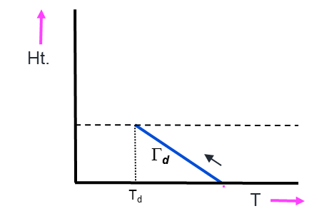
Most cloud forms as a result of air being lifted.
- When it rises, due to the drop of air pressure, it expands and cools.
- Adiabatic Process \(\Gamma\)
- Dry air will cool at the dry adiabatic lapse rate
- (10K per 1000 m)
Cloud formation
If \(T\) to drops to the dew-point \(T_d\) of the air:
- Condensation may occur on small particles in the air
- Forming droplets and creating clouds
- This is the lifting condensation level or LCL (~ cloud base).
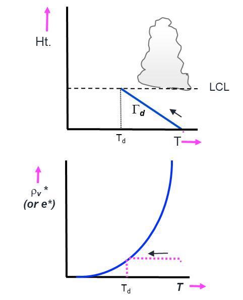
Lifting Condensation Level
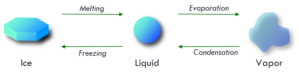
State changes of water
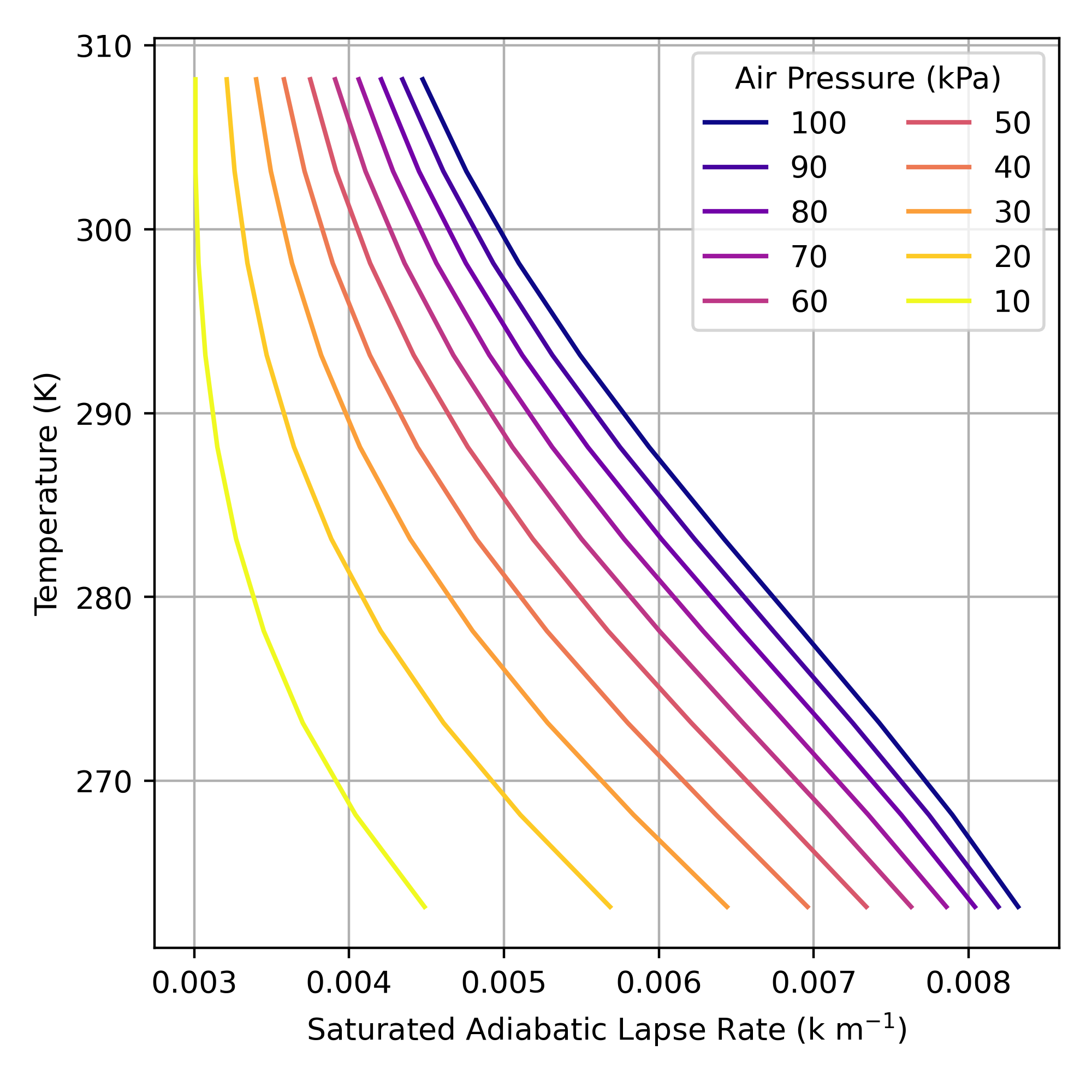
Saturated adiabatic lapse rate (SALR)
After saturation, the rate of cooling is reduced due to release of latent heat.
- SALR is not constant, it depends on:
- The amount of moisture condensed
- The laten heat release of condensation
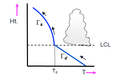
Saturated adiabatic lapse rate (SALR)
After saturation, the rate of cooling is reduced due to release of latent heat.
- SALR is not constant, it depends on:
- The amount of moisture condensed
- The laten heat release of condensation
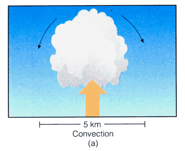
Convection
Cumulus clouds form as a result of convection
Convection
Some parts of the surface absorb more solar radiation than others, creating thermals
- If the thermal cools to saturation, moisture condenses to form water droplets, and it becomes visible as a cumulus cloud
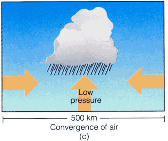
Convergence and Fronts
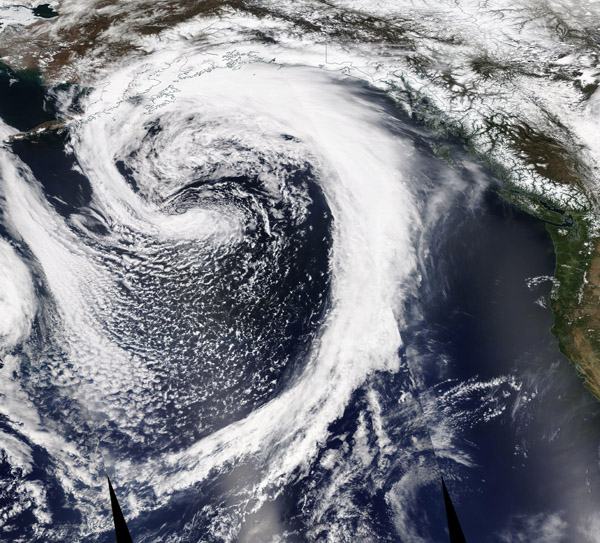
Low pressure systems result in large-scale cloud formation
Convergence and Fronts
A low pressure system causes air to converge (moving towards the center of the system) and rise on a large scale (100’s of kilometers).
- This causes widespread ascent of air, cooling and large areas of cloud.
- Multiple cloud types associated with low pressure systems
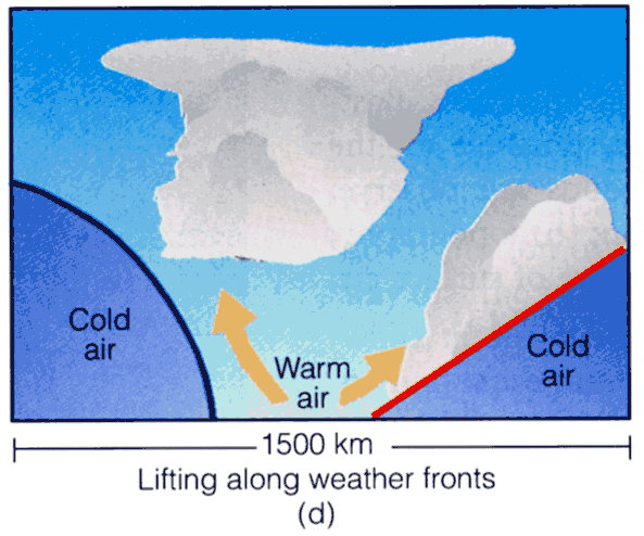
Convergence and Fronts
A front is a moving boundary between air mass that tends associate with low pressure systems.
- Cold front: advancing cold air mass
- Warm front: advancing warm air mass.
- Both force warm air to rise in bands along the fronts
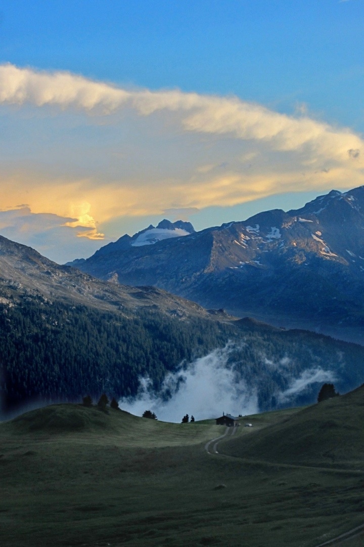
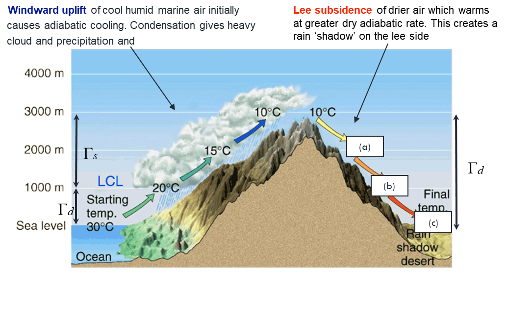
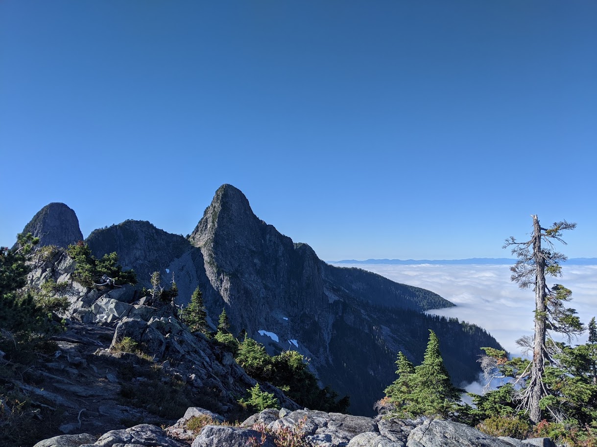
Orographic Lift
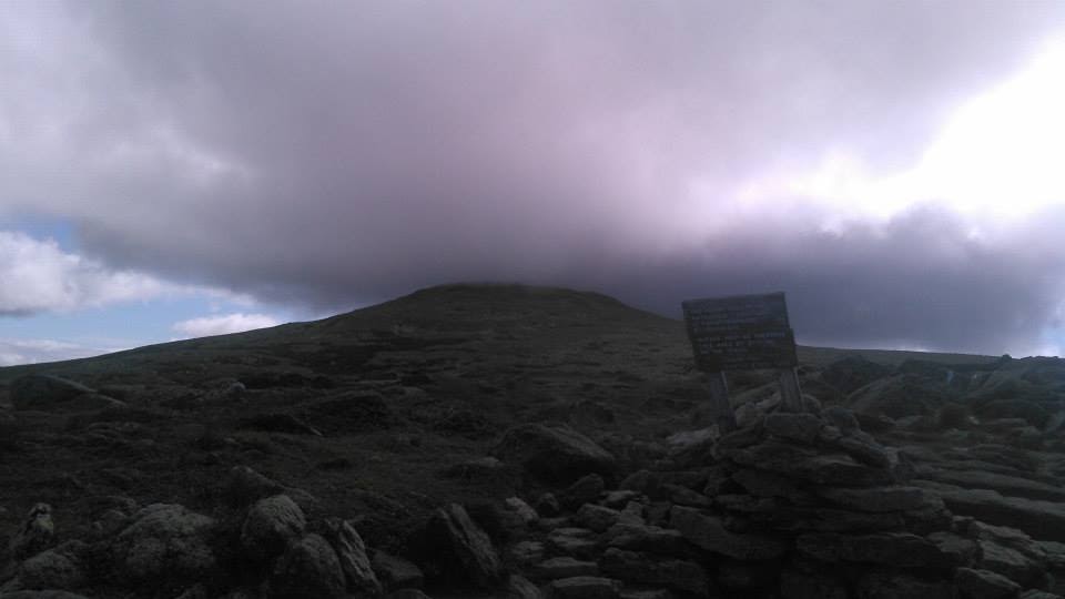
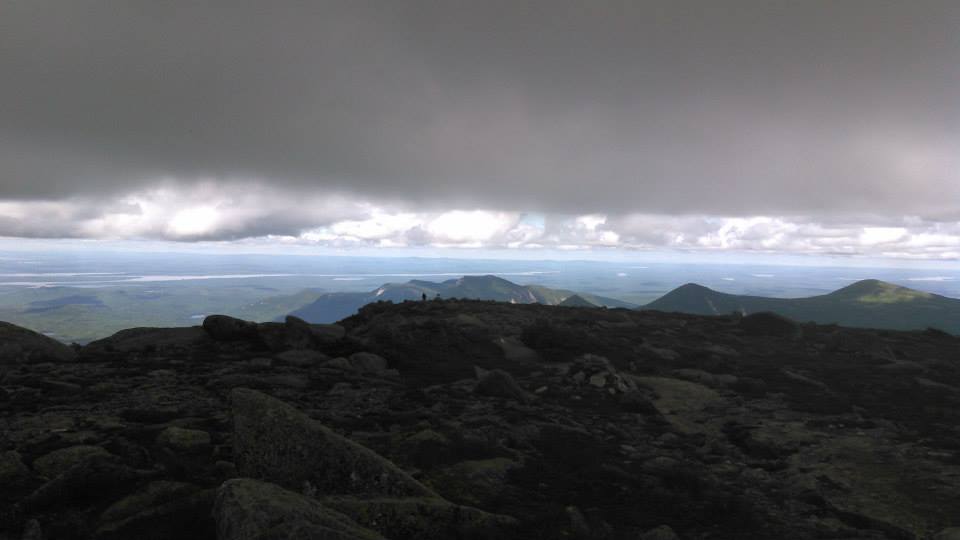
Orographic Lift
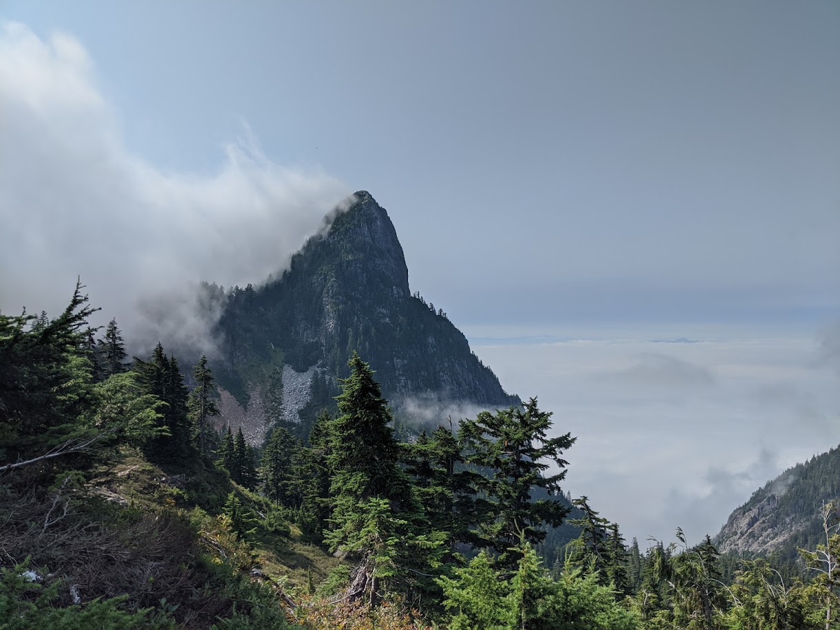
Clouds form on the up slope and dissipate on the down slope
Orographic Lift
Large masses of air rise when they are pushed over a mountain range.
- Forced lifting along a topographic barrier is called orographic uplift.
- Clouds produced in this way are called orographic clouds.
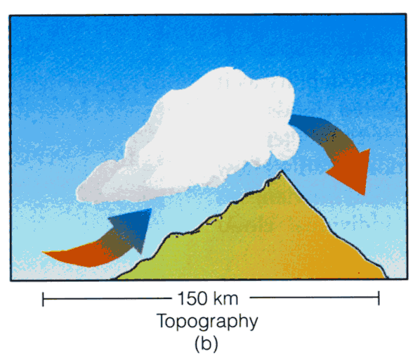
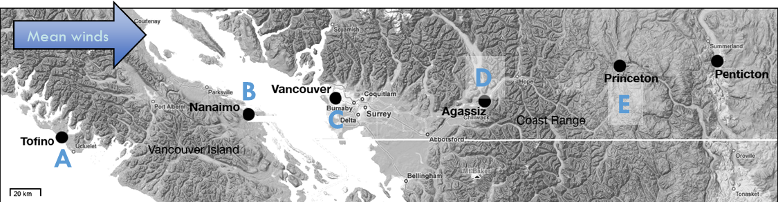
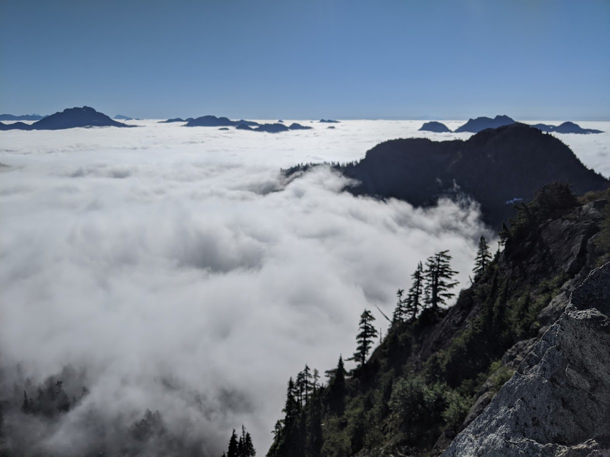
Rain shadows in the lee of major relief
iClicker
In British Columbia, where do you expect highest annual precipitation?
iClicker
Heavy precipitation on westerly slopes, warmer drier on easterly side (Gulf Islands, Sunshine coast, Okanagan).

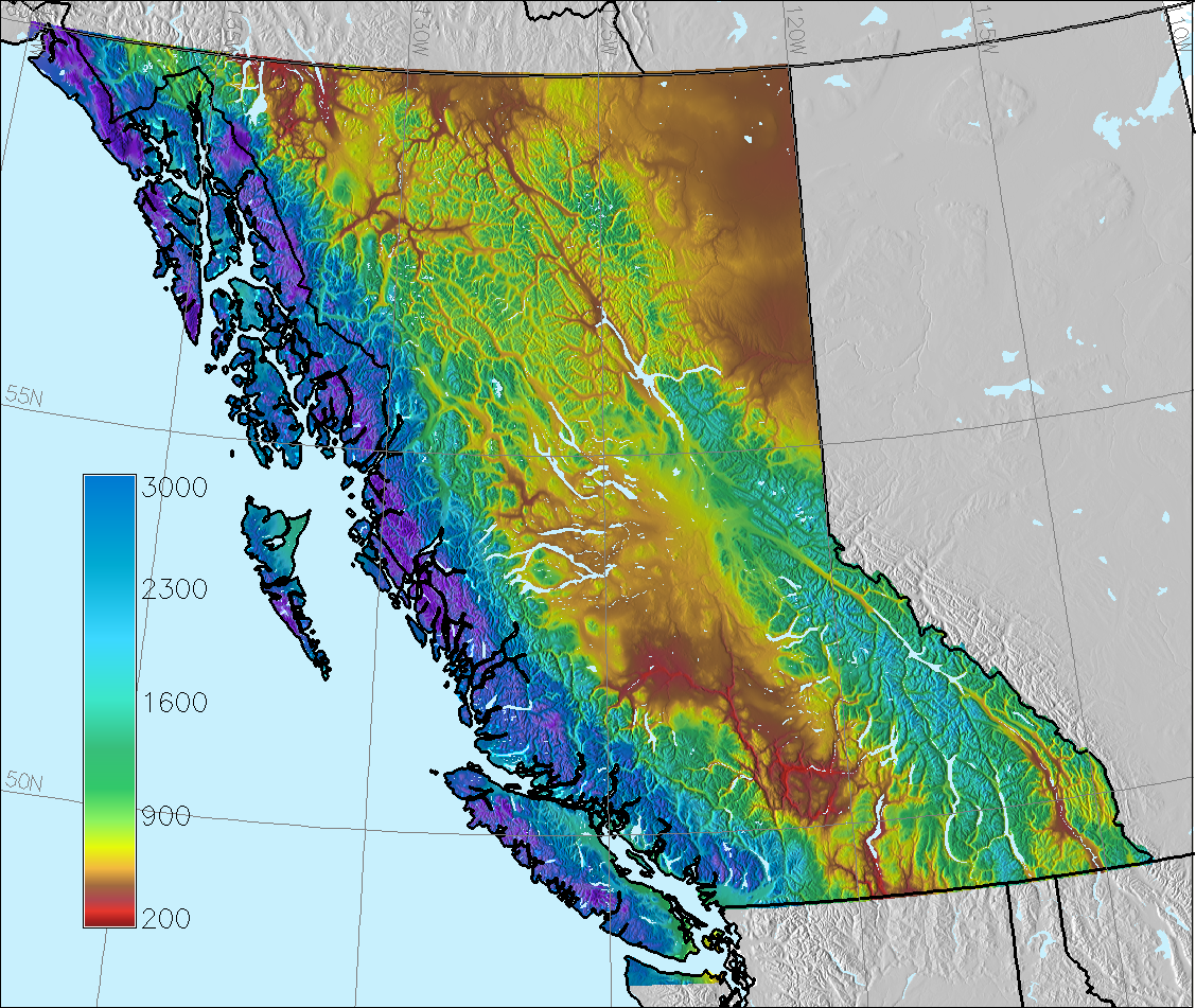
Annual Precipitation in BC (mm)
Radiative Cooling
Fog forms on calm-clear nights when radiative cooling causes surface air to cool below the dewpoint
Cloud types
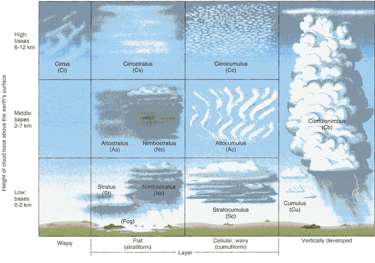
We categorize clouds by height, composition, and form
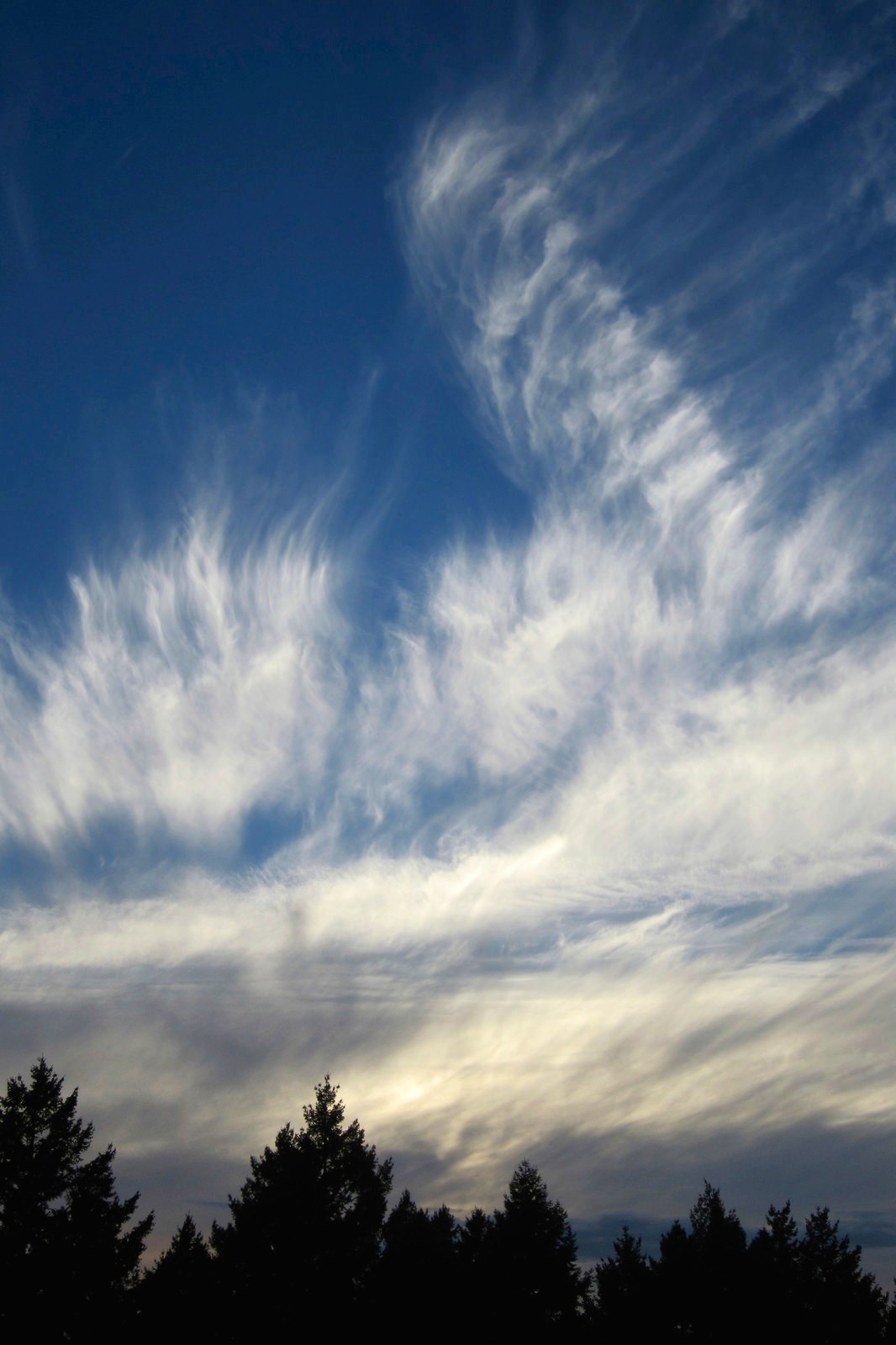
Cirrus (Ci)
High altitude ice clouds, appear as wisps. Photo: A. Christen
Cumulus (Cu)
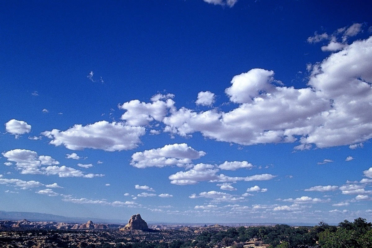
Low, liquid water clouds common in fair weather. Photo: A. Christen
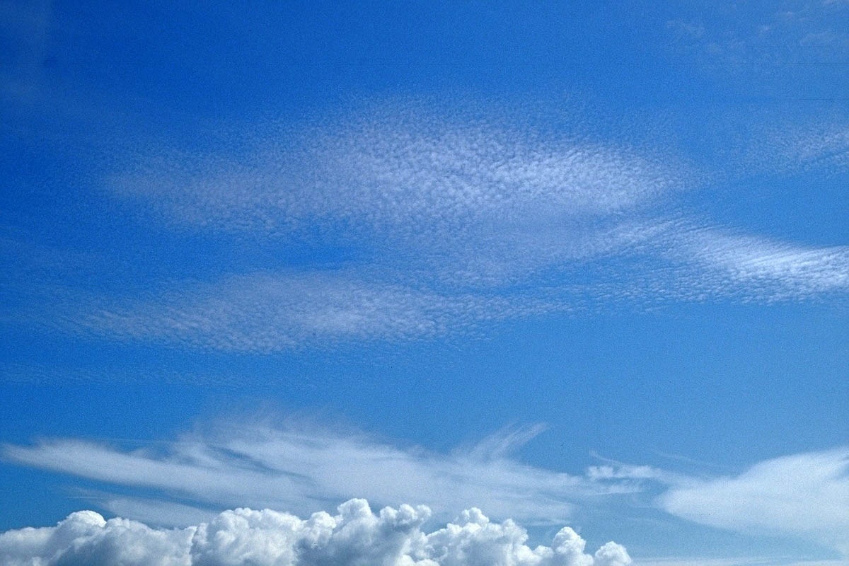
Altocumulus (Ac)
Middle level cumulus. Photo: A. Christen
Cirrocumulus (Cc)
Ice clouds as lots of puff balls, or in rolls (aircraft contrails). Photo: A. Christen
Cumulonimbus (Cb)
Large vertical extent; water droplets at low level, but upper levels are made of ice. Often lead to thunder storms and heavy showers. Photo: A. Christen
Stratus (St)
Layer clouds with base below 2 km (liquid water). Spatially continuous sheets over large areas. Stratus on the ground is fog.
Altostratus (As)
Middle altitude clouds with uniform structure. Often due to an approaching frontal system. Photo: A. Christen
Cirrostratus (Cs)
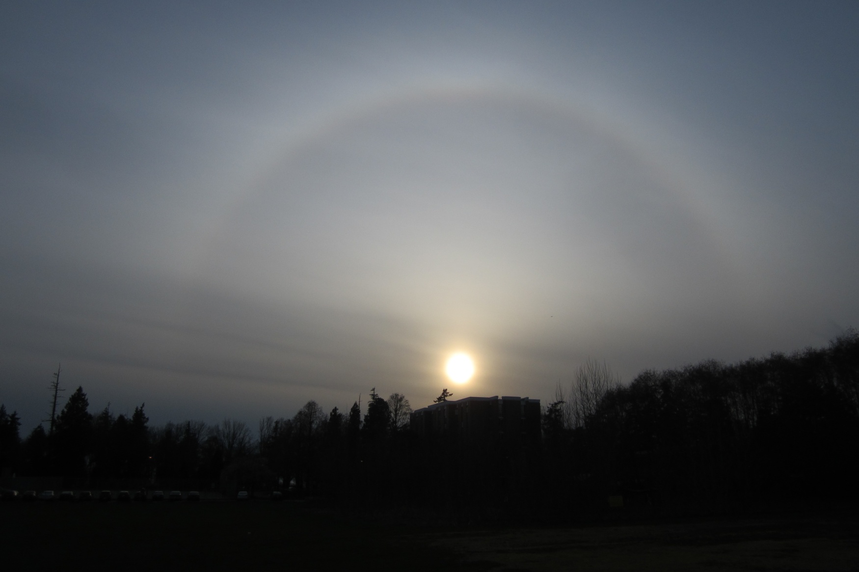
Fibrous outline gives halo around Sun or Moon due to the refraction of light by thin layer of ice crystals, here above UBC Totem Field. Photo: A. Christen
Nimbostratus (Ns)
Thicker layer clouds associated with fronts and light or drizzly rain.
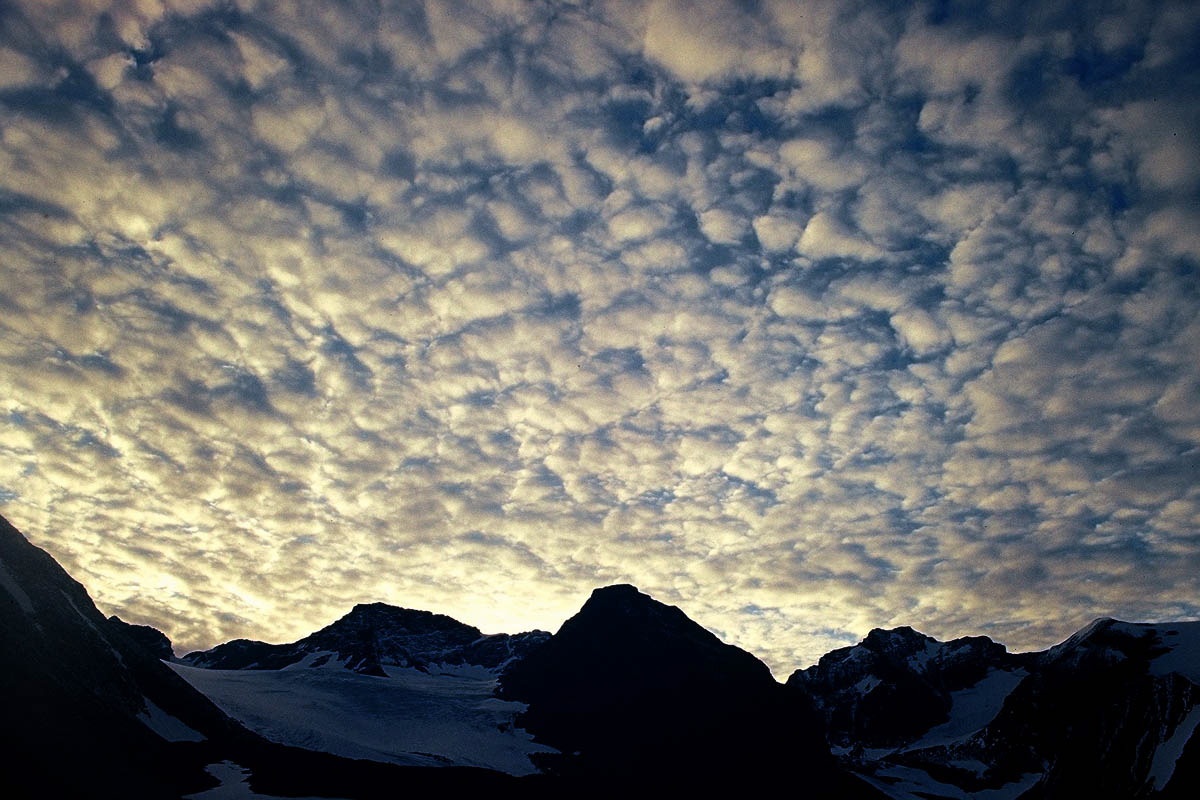
Stratocumulus (Sc)
Low clouds, wider than tall – look like pancakes. Less clear space between than cumulus. Photo: A. Christen
Cloud-quiz (iClicker)
Which clouds are made entirely of ice-crystals?
Cloud-quiz (iClicker)
Which clouds are cumulus clouds, often found on a sunny summer day?
:::
::::
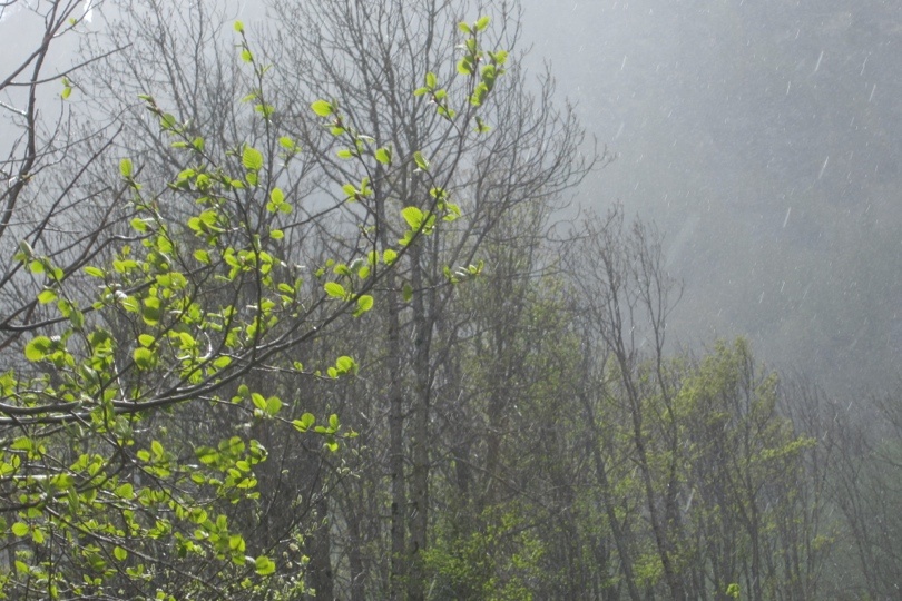
Fog
Fog is a cloud that forms near at surface.
- Cooling of the air
- Radiation, advection, and upslope fog
- Addition of moisture
- Steam and frontal fog
Precipitation
Droplets must be larger than 100 μm to have any chance to get to the surface.
- Typical rain drops are 2000 μm (2 mm) and have a terminal velocity of 8.8 m/s
- To reach this size, must be processes to let droplets grow in clouds
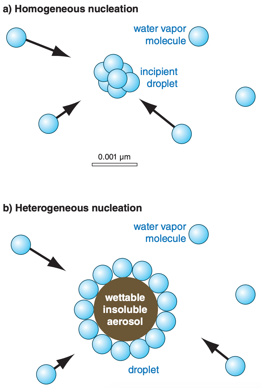
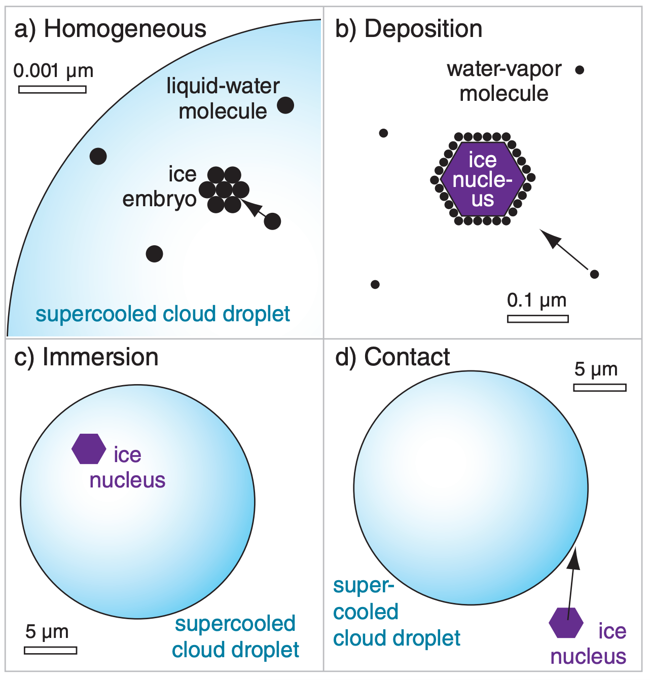
Nuclei
Required for water to condense or freeze in the atmosphere.
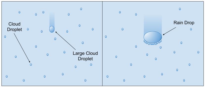
Collision-Coalescence Process
Larger droplets fall faster than smaller ones and collide and combine with them. After many collisions, large droplets are big enough to overcome updrafts and survive evaporation on the way down.
- Need a spectrum of droplet sizes to work – many very small, a few large ones
- Mainly occurs in the tropics
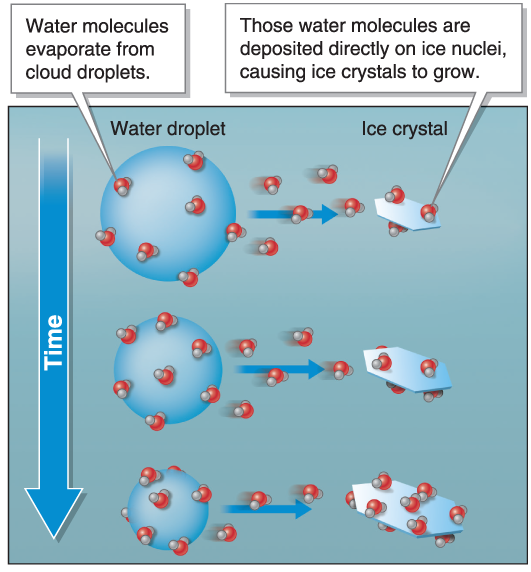
Three-phase Process
Requires a mixture of ice crystals, water droplets, and water vapor co-existing at temperatures below freezing
- Depends on the fact that saturation vapor pressure over surface of ice is slightly lower than over liquid water
- Small gradient exists, from liquid to ice
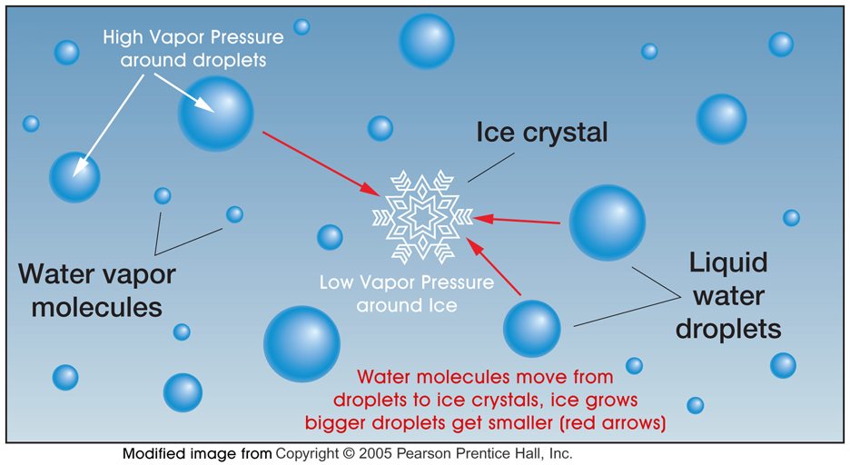
Three-phase process
Saturation vapor pressure is slightly lower around ice crystals than water droplets; ice has tighter bonds than liquid water.
The ice crystals collide and stick and hook together, forming snowflakes and growing large enough to fall
Most of the rain falling in middle latitudes (even in summer) begins as snow