Weather Systems
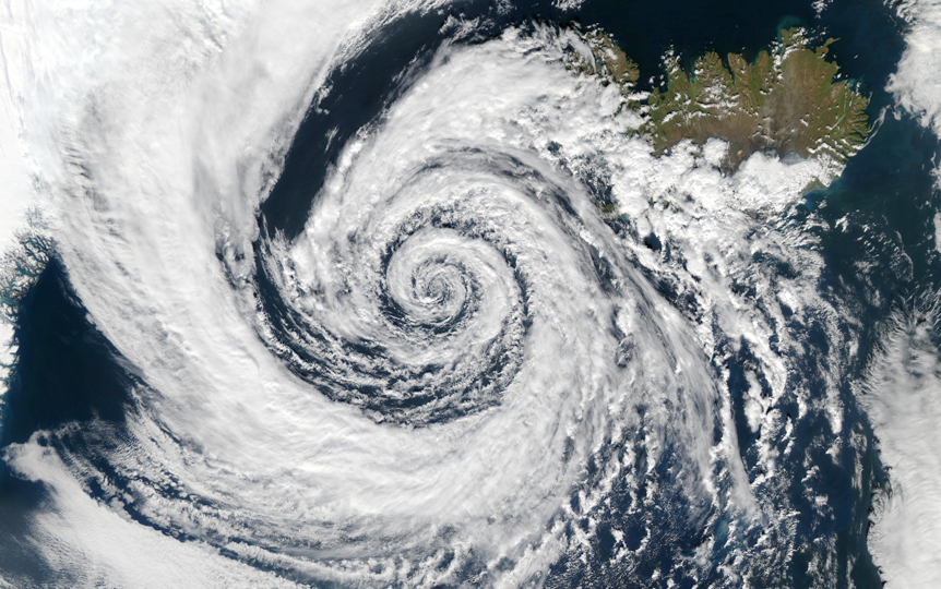
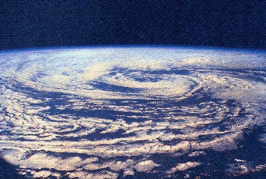
A low pressure system over Iceland (Photo: NASA)
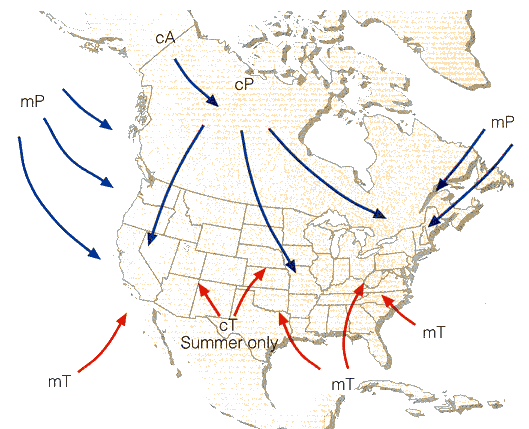
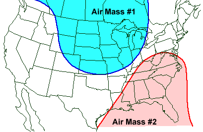
Air Mass Types
Air masses are classified according to their source region
- Maritime Tropical (mT): Warm & moist
- Continental Tropical (cT): Hot & dry
- Maritime Polar (mP): Cool & moist
- Continental Polar (cP): Cold & dry
- Continental Arctic (cA): Frigid & dry
Test your knowledge (iClicker)
Which of the air masses listed below would be #1 and #2 respectively in the figure below?
- A: cP and mT
- B: mP and cT
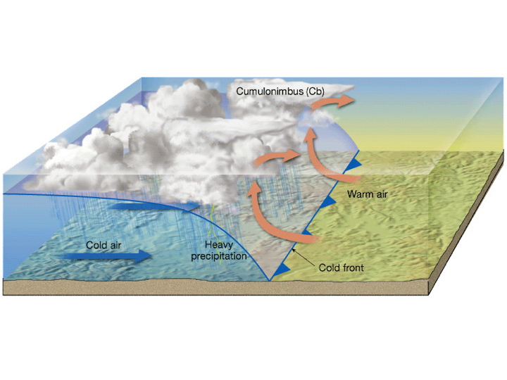
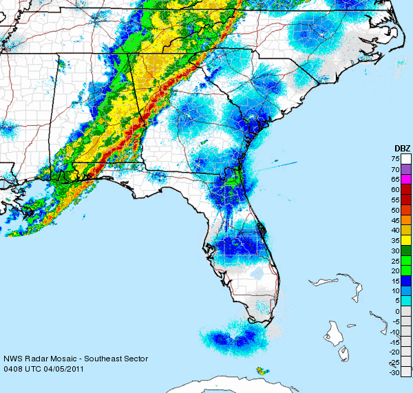
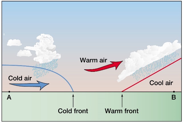
Cold Fronts
Cold, dense air “undercuts” warm air forcing it aloft along the front. Commonly associated with:
- Cumulonimbus clouds & heavy rain
- Strong wind & severe weather
- Followed by clear skies
- Typical slope 1:40 – 1:50
Cold Fronts
How would you know if a cold front occurred?
- Heavy rain followed by a temperature drop and cold clear high pressure air
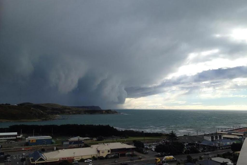
Severe Weather
Rapid upward displacement of warm air >> intense storms
- High winds
- Heavy rain
- Hail
- Lightning
- Tornadoes possible
Warm Fronts
Warm air gradually rides up over colder air ahead of it. Commonly associated with:
- Stratus clouds and moderate rainfall or snow
- Less intense but more widespread
- Followed by warmer conditions
- Typical slope 1:100 - 1:150
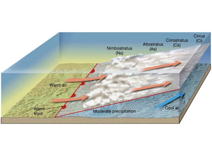
Cloud Sequence of a Warm Front
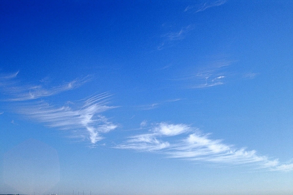
Cirrus clouds are the first to appear
Cloud Sequence of a Warm Front
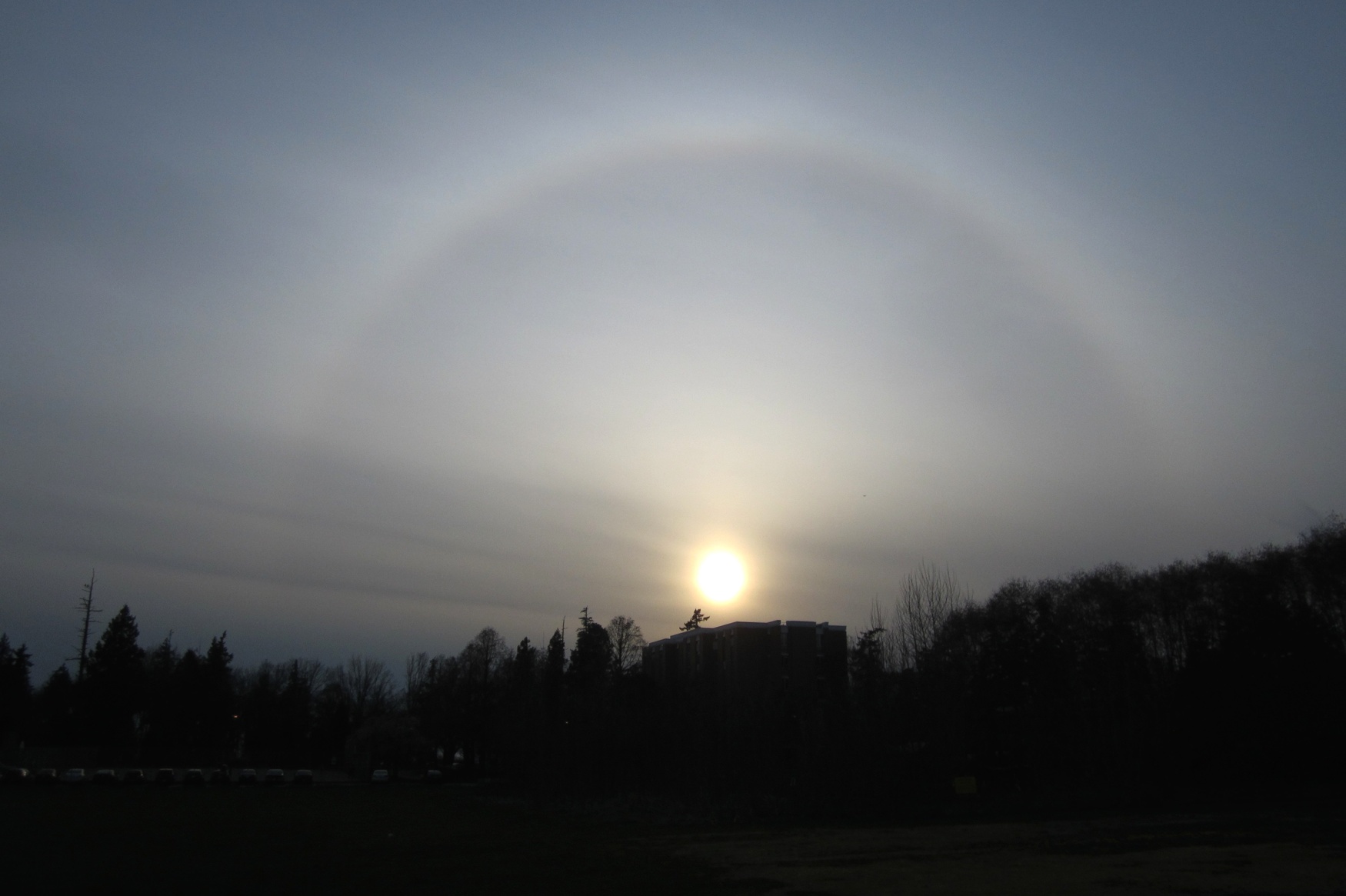
Followed by cirrostratus as the cloud deck lowers
Cloud Sequence of a Warm Front
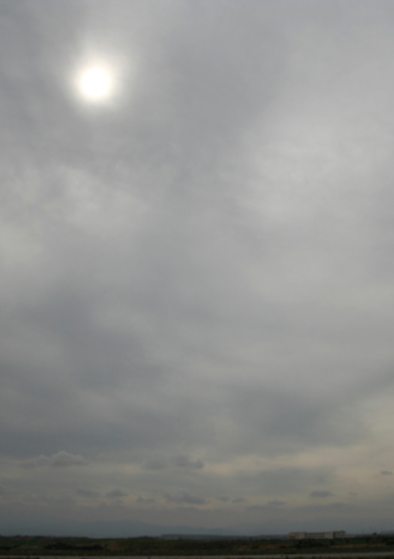
Then a transition to altostratus as the cloud deck continues to lower
Cloud Sequence of a Warm Front

Finally nimbostratus clouds and precipitation once the frontal boundary is close enough
Movement of Fronts
Cold fronts and warm fronts are continuously chasing each other around the mid-latitudes
- Cold fronts travel faster than warm fronts, so they eventually catch up
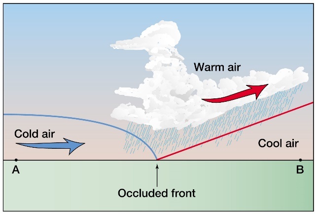
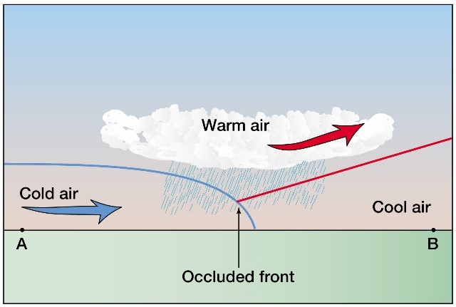
Occluded Front
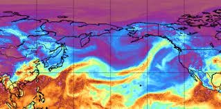
Jet Streams
Ribbons of high speed winds (160-400 km h-1) encircling the globe aloft (10-15 km).
- Snake around the globe from W to E and steer weather disturbances (mid-latitude Lows)
- Generally aligned with air mass boundaries at the surface
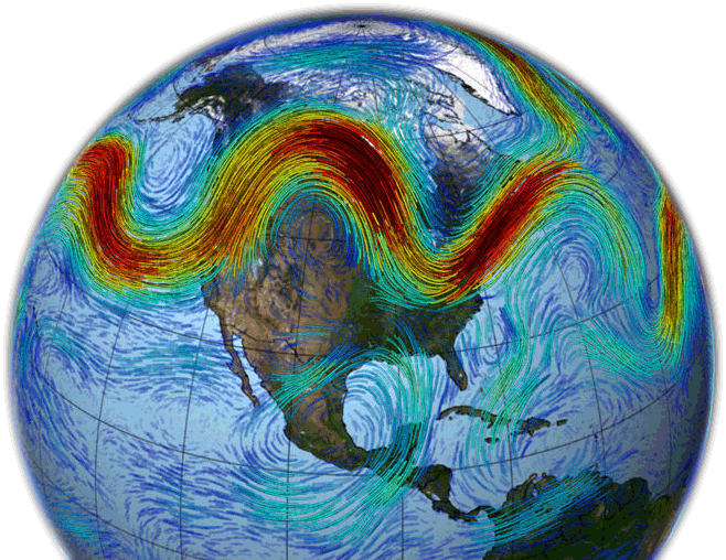
Jet Streams
Flow dynamics in jet streams promotes the formation of high and low pressure systems.
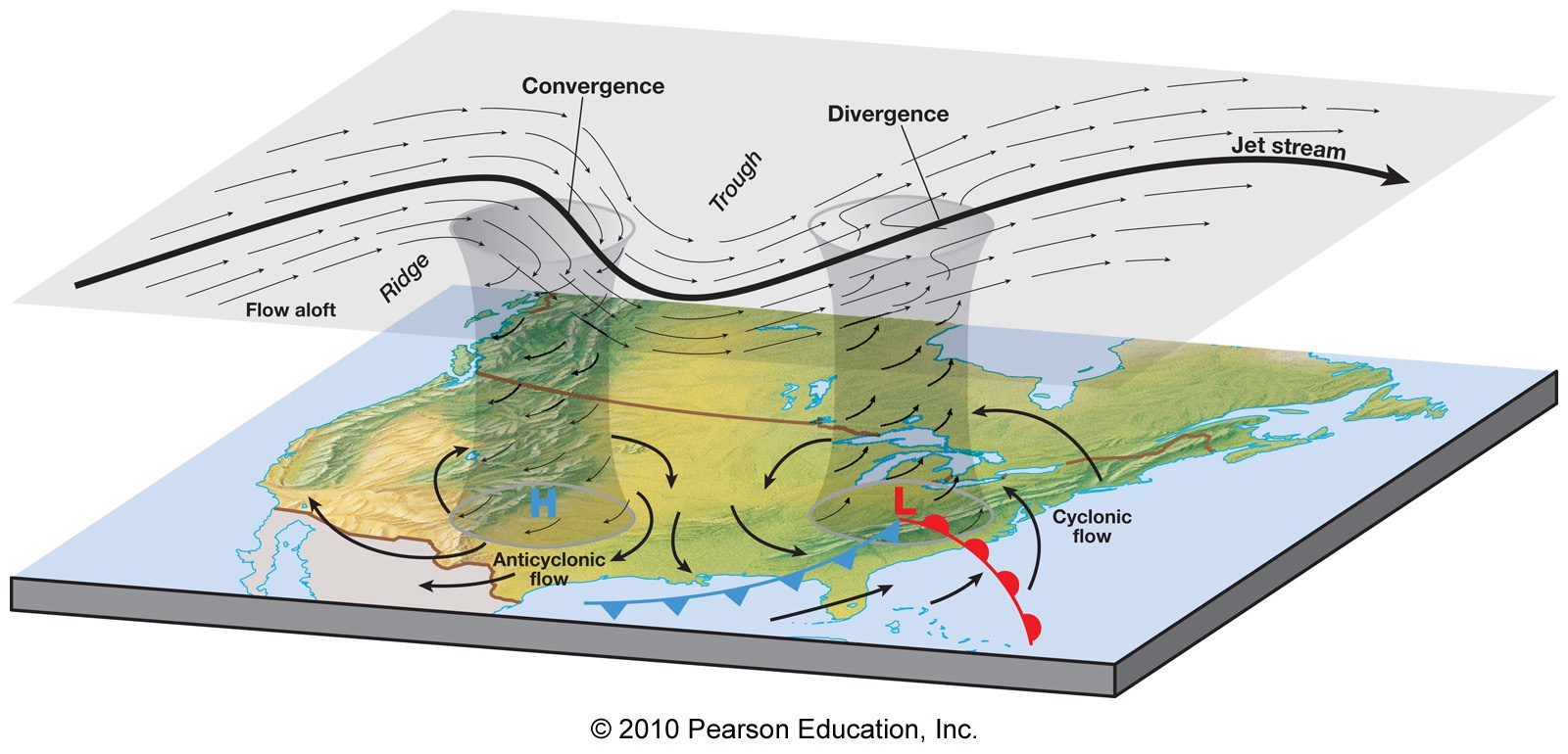
High and Low Pressure Systems
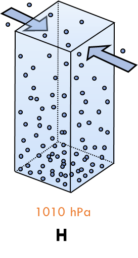
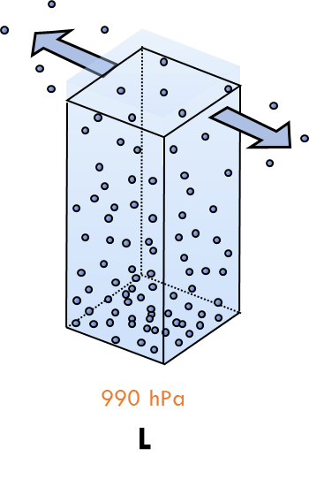
Link Between Jet Stream and Ground
To form cyclones, it is important to consider the form of divergence in the jet stream.
- Cyclones cannot persist if they do not have upper-level support.
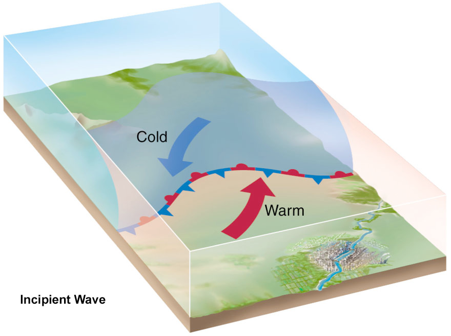
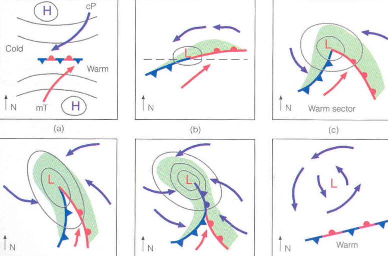
Life Cycle of Cyclones – Early
Stage starts with a relatively stationary front separating polar (cold) and subtropical (warm) air masses.
- A slight dynamic low created by the divergent jet stream aloft pulls air in, so cold air penetrates into the warm air, and warm air moves towards the cold air.
- The center of the disturbance starts to rotate.
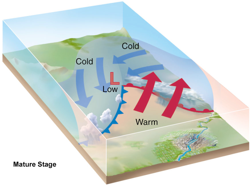
Life Cycle of Cyclones – Open
Two fronts (one cold, one warm) are evident.
- The denser cold air undercuts the warm air, and the warm air overrides the cold air ahead of it
- The uplift is enhanced by the release of latent heat, as ascending air rises above the lifting condensation level & cloud develops.
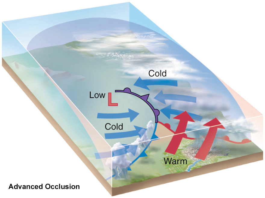
Life Cycle of Cyclones – Occlusion
The occluded stage begins when the cold front catches up with the warm front near the low pressure center.
- The cold air at ground level undercuts the warm air pushing it further aloft.
- The ‘warm sector’ is systematically eliminated, as more cold air comes in.
- This influx destroys the system.
Life Cycle of Cyclones - Dissolving
The dissolving stage is the end of the cyclone’s life.
- Warm air aloft is separated from its source and gradually mix with the surrounding cold air.
On a Weather Map
Forecasting
Environment Canada is responsible for weather forecasting and research.
They have multiple office located in Vancouver and Victoria
Specialize in prediction of coastal and mountain weather

Forecasting Challenges in British Columbia
- Mountains and complex terrain
- Sources of moisture
- Pacific data void
- Lack of observational data upstream of BC
Extreme Weather: Heat Domes
Intense high pressure systems that set up over an area and persist for days or weeks.
- Subsidence causes intense adiabatic heating and suppresses cloud formation
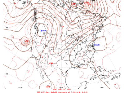
Extreme Weather: Heat Domes
Intense high pressure systems that set up over an area and persist for days or weeks.
- Subsidence causes intense adiabatic heating and suppresses cloud formation
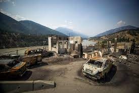
- Exacerbates fire risk
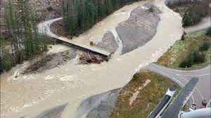
Extreme Weather: Atmospheric Rivers